


The Once and Future Soho

Is there a trove of historically valuable treasures buried, waiting to be discovered, under some pricey dirt in lower Manhattan?
The answer is probably yes, according to archaeologists contracted by the de Blasio Administration to analyze blocks of land in SoHo and NoHo in preparation for a planned rezoning.
That rezoning, proposed in the fall of 2020 and certified this spring amid intense, and still ongoing local opposition, would, if it goes as promised (a big if) bring some important changes to a swath of SoHo and NoHo, changing artist certification requirements and allowing residential and larger commercial development, and building thousands of new housing units, approximately 900 of them affordable, to the area roughly bounded by Astor Place, Sixth Avenue, Lafayette and Canal Streets.
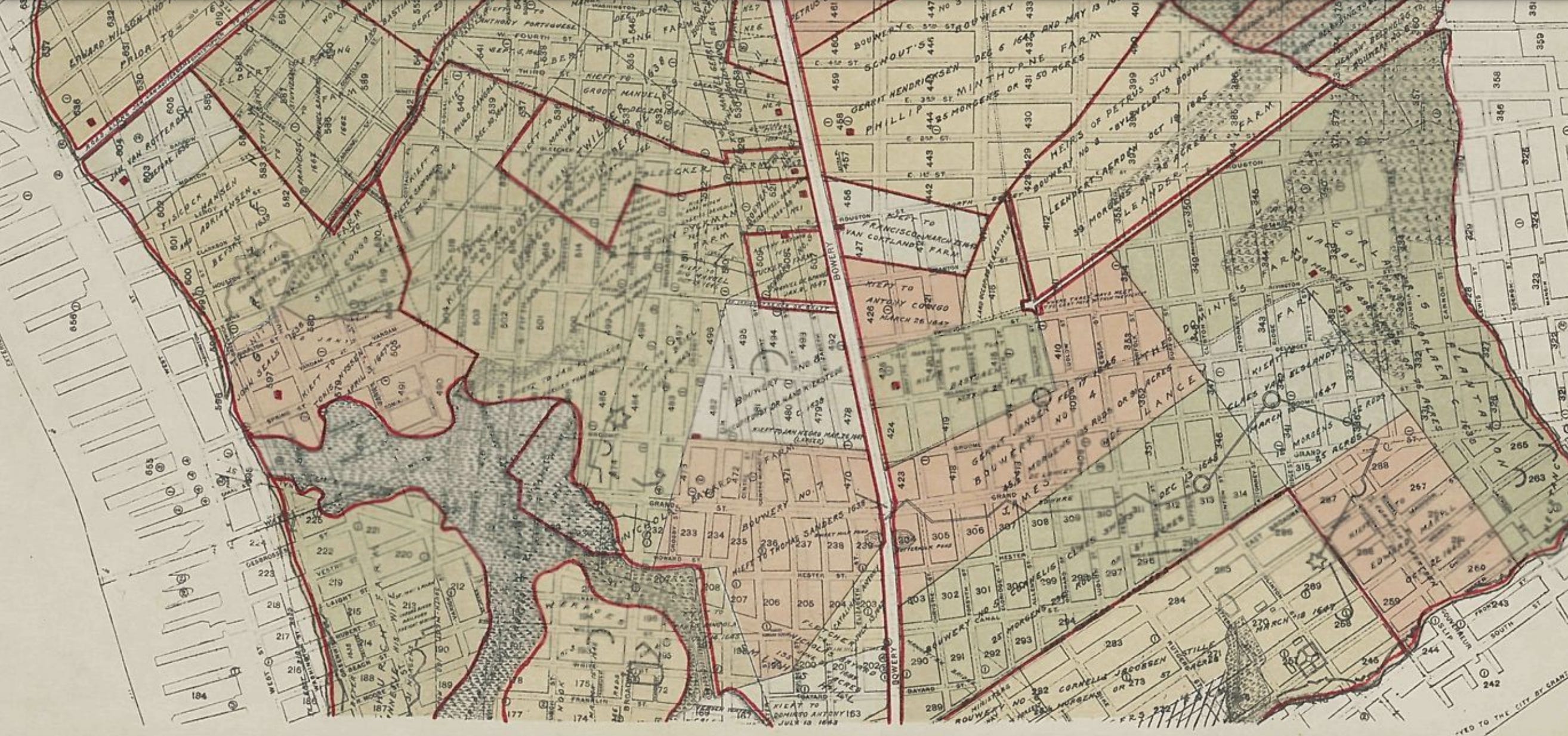
The archaeological review, required under city planning laws, found that on at least 20 different parcels considered likely to be redeveloped under the rezoning, from West Broadway, to Lafayette Street, to Crosby Street, there are “potentially significant archaeological resources,” including possible artifacts or remnants from the 17th century, when the area was a neighborhood of enslaved people of African descent who’d been brought to New Amsterdam by the Dutch in the early and mid-1600s.
In the intervening centuries, widows, tailors, candlers, Tammany politicians, bookmakers and brothel-owners, of German, Irish, French, English and African origin lived and worked at the handful of addresses now slated for redevelopment. It’s not hard to imagine that they may have left behind little bits of evidence of their existence on plots of land that have been in continuous use for hundreds of years.
But there’s a possibility we may never find out whether those plots hold anything wonderful or important. Even though the archaeologists determined the sites “should be archaeologically tested,” that has not happened yet. Under current city and state and federal laws, whatever artifacts are there are likelier to be destroyed than preserved if the land is redeveloped (a scenario that could certainly happen without the rezoning but which the rezoning makes more likely) and isn’t within a landmarked district or building.
The sites are privately-owned, and city planning department officials say the city has “no mechanism” that would compel an owner or developer to conduct further analysis or excavation on their property, no matter how potentially valuable the objects it may hold could be.
17th Century
“Small groups of enslaved persons of African, Portuguese and Spanish descent” were among New Amsterdam’s earliest residents. Eleven enslaved men arrived in 1621; three enslaved women in 1628; and fifty enslaved persons in 1630,” the city’s SoHo rezoning archaeological review explains. We know vanishingly little about these people, beyond names and a few scant details.
Under Dutch rule, some among the original 11 men transported to Manhattan were, “along with their wives but not their children — granted ‘half freedom’ by the Dutch colonial government in 1644. This partial emancipation included rights to additional land grants,” the review says.
At least five of these men — Gratia d’Angola, Manuel Gerrit de Reus, Manuel Trumpeter, Jan Francisco and Jan Negro — lived and farmed in an area within or near the land affected by the possible SoHo rezoning.

“Largely due to these land grants, areas within the modern neighborhoods of SoHo, Greenwich Village, and the East Village became the site of one of the first “relatively independent communities” of Africans and persons of African descent in New York, the review found.
One of those sites is 220 Lafayette Street. Right now it’s a nondescript three-story building with retail in the ground floor, but 380 or so years ago it was part of “Bouwerie No. 8,” one of the original farmsteads established by the Dutch government on the island of Manhattan in the early 17th century. In 1647, New Netherland Director General William Kieft granted part of the land to Jan Negro.
Plots of land at 81 Mercer Street, (a vacant lot), at 395-397 West Broadway, (currently a single-story Eileen Fisher store) and at 144 Spring Street (currently a vacant lot), all slated for redevelopment under the rezoning, were all part of a small land grant Kieft made to Jan Francisco sometime before 1644.
Land at 463 West Broadway (currently a two-story building with a bakery on the ground floor) was part of a grant made to Gratia D’Angola, in 1644. Kieft granted the land at 686 Broadway to Manuel Trumpeter around the same time period.
Imagine, nearly-four century-old remnants from the city’s first Black farmers could be resting, right now, in a few feet of earth underneath the Cosabella lingerie store on Lafayette Street.


“Rotten Row”
Archaeologists think it’s probably totally unlikely any objects have survived from the Native Americans who once lived in the area that’s now SoHo and NoHo. And while uncovering artifacts related to the city’s 17th century Black residents is a pretty exciting possibility, the experts think it’s a long-shot, though not impossible. Most likely, the sites may hold bits and pieces from the early and mid 19th century, when the whole area was a hopping hive of commerce and sometimes debauched activity.
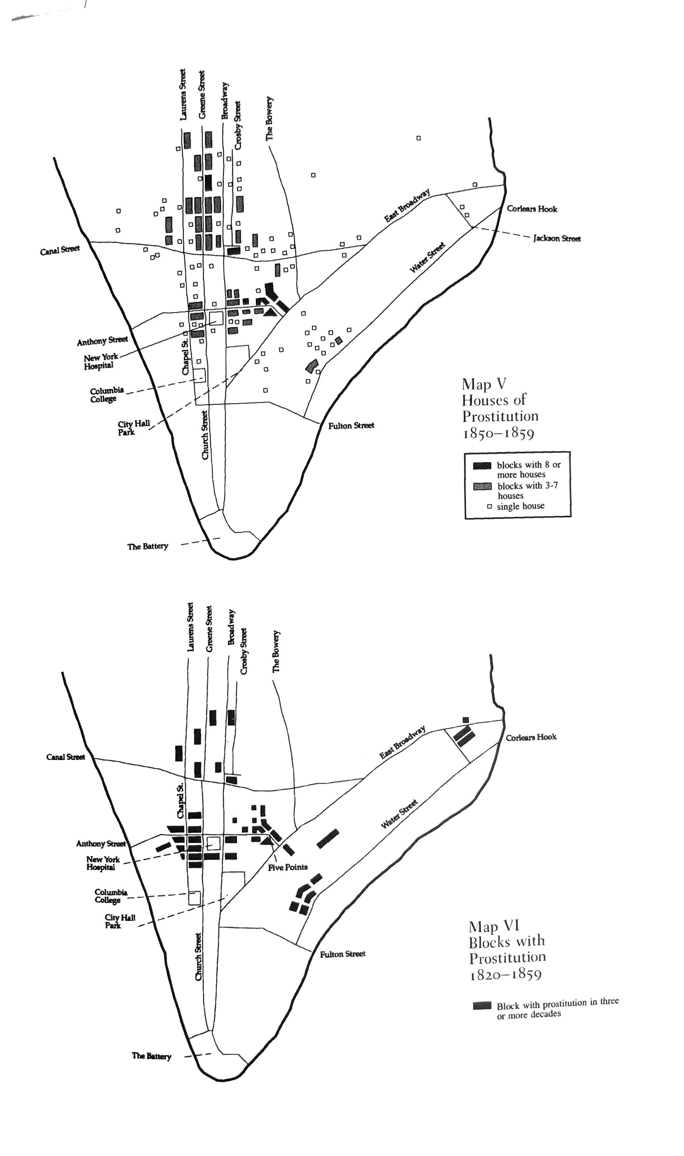
In the early 19th century, the area of West Broadway above Canal Street was known as “Rotten Row” — home to a high concentration of the city’s brothels, and notoriously unsanitary conditions, which an official 1850 city report described thusly: “The pestiferous stench and filth of these pent-up tenements exceed description.”
For most of the 19th century, West Broadway was known as "Laurens Street,” named for Henry Laurens, a slave-owning South Carolinian and president of the Continental Congress, whose son John (played by Anthony Ramos in the musical ‘Hamilton’) was killed during the Revolutionary War.
In 1870, in an effort to raise property values, the city took a crack at rebranding the street whose name had become synonymous with sex trade and violent crime, and tried changing Laurens Street to “South Fifth Avenue.” It didn’t take. In 1895, the city successfully renamed the northern part of the street West Broadway.
The 20 or so addresses that the city identified as possible sites of objects of archeological significance have gone through dozens of iterations and incarnations in hundreds of years of continuous human occupation. More precisely, in the years between 1820 and 1870, city historical directories show these 20 addresses alone were home or workplaces for more than 600 heads of households, not including children and other dependents.
Between 1828 and 1856, 138 Canal Street was home to; dry goods sellers, a widow, a hatter, a confectioner, a comedian named Moses S. Phillips, a painter named Lucy James, a saddler, a clerk, a professor of music, a professional musician, several grocers, liquor store owners, shoemakers and upholsterers, as well as an optician, a daguerreotypist, a sausage maker and a purveyor of “ladies furnishing goods.”
Milliners and publishers and importers and photographers, and maybe even a brothel operator by the name of“Madame Delorme” lived or worked at 391 Canal. Over thirty years, from the 1830s to the 1860s, the little plot at 48 Laurens Street (now 355 West Broadway) was home to stables, multiple tailors, a painter named James Gilm, seamstresses, coachmen and an ice cream company called Convers & Flassilard.
Over 44 years from 1826 to 1870, a succession of nine different widows took shelter, and worked, at the house at 76 Grand. Though dozens of renters came and went, the property has only had five owners since the 18th century — it stayed in the hands of the once-illustrious Betts family from the 1700s through 1927.
The directories and the census records for just these 20 addresses contain a wealth of information about the way New York’s jobs changed, how the ethnicities changed, how trends came and went. Some addresses were homes of portrait and miniature painters and others of masons. In the 1830s, one spot was home to a cupper and leecher, a profession that seemed to go out of style in the following decades. Druggists, jewelers, pilots, a sodawater maker, vestmakers, sailmakers and police officers all lived here.
Some addresses are case studies in the rise and fall and resurrection of a neighborhood’s reputation. The three story building at 121 Mercer Street, (known as 149 Mercer since 1875) was an elegant private residence in the early 19th century, but by the 1850s it had become “the site of a well known brothel operated by ‘Mother Coleman,’” who “was witnessed entertaining police officers with corned beef and Croton water at her establishment in 1859,” the archaeological review found. By 1865, it had become a “disreputable house kept by Mary Ann Sickles.”
The house at 149 Mercer Street is still standing, despite multiple fires. It’s gone quite upscale, with luxury retailer Balenciaga in the ground floor. The one-bedroom apartments on the floors above rent for upwards of $8,000 a month.
Some addresses were places of extreme sadness, and suicide attempts and arsons and murders.
In a boarding house at 341 West Broadway, a man named James Burns beat his wife Anna to death in 1859. In the same rooming house that year, a German immigrant named Andrew Wolf died of exposure and hunger in his cold, rented attic room. The building at 337 West Broadway (formerly 30 Laurens Street), was “‘a dive’ where criminal activity occurred frequently and eighteen people, including both men and women of African and European descent, were arrested in a single police raid in February 1870,” the archeologists’ report shows.
Some of these addresses were homes of the least powerful, least heard-from and written-about people in New York, and some were home to the most powerful. Some addresses were home to both, over the course of centuries. In the years immediately following the end of the Civil War, historical directories list at least 20 residents at these addresses who were people of “African descent.” Other addresses were boarding houses, homes for widows and women young and old working as laundresses or seamstresses or domestic servants. What if the people who lived here, whose history has so often been written by others, left behind some junk or refuse that could tell us more about who they were?
220 Lafayette Street, the land Jan Negro farmed in the 1640s, had, by the 1860s, become a very fine house. That was when it was home to powerful 14th Ward politician James “Jimmy” Hayes, a Tammany Democrat and City Councilman close with Boss Tweed. Hayes was stabbed by a man who suspected Hayes was sleeping with his wife. Another plot, at 32 Great Jones Street, now a humble parking lot, was once home to Orlando B. Potter, a lawyer and real estate developer eventually elected to the House of Representatives in the mid-1800s.
Some places actually didn’t change very much at all. Today, the occupant of the squat two-story building at 463 West Broadway, formerly 144 Laurens Street, is a bakery named Sadelle’s, owned by the same restaurateurs who run the fashionable Italian restaurant Carbone. The address has actually been home to a bakery of one kind or another for a significant part of its existence. Between 1831 and 1838, baker William R. Forsyth worked there. Between 1848 and 1873, Prussian immigrant Christian Henry Kobbe, a baker, ran his bakery there and lived onsite, with his wife and children and bakery employees.
A lot of living and dying happened in the 56 city blocks set for rezoning.
Much of the attention paid to the SoHo rezoning is quite rightly focused not on the past and the people who used to live there, but on the future, on those who do and someday will live in SoHo, on what the city’s plans will mean for current residents and businesses, and whether the planned changes will actually accomplish de Blasio’s intended goal — providing housing that’s affordable to the people who want to live and work in New York, without squelching what’s still beautiful about the neighborhood.

The area is impossibly expensive, and many of its storefronts are empty. Grocery and drug stores are far and few in between. During the height of the pandemic in April 2020, it became a ghost town, an outdoor history museum, where I walked the streets for hours administering a self-guided architectural tour of the cast-iron buildings without running into more than a handful of other human beings on the sidewalk. The blocks and blocks of beautiful, empty streets reminded me of the well-preserved ruins of Pompeii. This neighborhood needs some new life, somehow.
But it would also be sad if, in planning the neighborhood’s next chapter, in digging deep so we could build higher, in an effort to give other New Yorkers a chance to come and crowd again in buildings on streets that once teemed with so many people, we somehow ended up destroying something — some little artifact or object that might tell us something important or new about who we used to be.
Read the Draft Environmental Impact Statement and some of the history here.
Honestly, archaeological mitigation should be mandatory across the city. There are areas nearly as old or older all over the place. For instance, I live a stone's throw from Gravesend, extant as a town founded by an Englishwoman (though at the time, under Dutch auspices) since the mid 17th century. And obviously there was a Lenape presence before that. If there has ever been any archaeological activity, resultant of a requirement to do so or not, I have never heard of it or seen proof of it.